Thursday, February 10, 2011

The Southern Alps and Fiordland

1. Glaciers                                                                                                                       Thursday, Feb. 3rd
Leaving Lake Matheson we leave behind the mosquito, only to enter the land of the sandfly.  They are dreadful, pesky little creatures with a nasty bite that leaves ugly measle-like red dots and welts.  In the Southern Alps area it seems that everyone's legs and arms bear the marks of these swarming attacks.
Franz Josef was teeming with tourists.  Everyone scuttering about  positioning themselves to get the best view of the glacier.  As for Canadians (especailly Western Canadians)  who are down here to get away from the snow it's hard to  get into the spirit of the thing.  Also, the fact that Don and I were recently in Alaska where there are more glaciers than anywhere else in the world we felt we were well enough acquainted with the rivers of snow.    However, we stopped for a look and the obliglatory photo op. just to prove that we had been there and then carried on.
We arrived in Wanaka in the pouring rain.  Stopped only long enough to gas up and carried on to Queenstown.  Still nothing to tempt us to stop so we carried on to Te Anau.  It is still raining but we have driven here for a purpose - to go on a fiords cruise.
Fiordland, the name generally given to the southwest coast, is a majestic wilderness of rocks, ice, and beech forests, where glaciers have carved mile-deep notches into the coast.  Rivers, sounds, and lakes eat away at the land, and it rains hard and often, so that the area seems to strike a tenuous balance between earth and water.

Most of the area is a UNESCO World Heritage Area.  Parts of the park are so remote that they have never been explored.

2. Go Millford
We booked a bus tour to drive the 120 kms to access the fiord cruise.  That would allow Don  a break from driving and the chance to just enjoy the scenery.  Rhyse, the driver,  was a friendly fellow who had spent a lot of time in Canada and the US.  He said the moment you drove across the border between the two countries the atmosphere changed.  Interesting to hear a visitor say this. He said that maybe it was because, like NZ and Australia, Canada is a Commonwealth Country. Kindred spirits!


Rhyse, bus driver 

I'm sure that NZ has more rivers and streams per square km than any other country in the world.  As a result there are more single lane bridges than anywhere else in the world.  On the drive from Te Anau to Milford Sound, Rhyse told us that we crossed 137 bridges.
The technique to cross the one-lane bridge is to  pause long enough to determine if the coast is clear and whether you have the white arrow (your go) or the red arrow (give way).  A few days earlier  Don and I had  crossed one that did make us scratch our heads.  It was a single lane bridge with the added twist of a train track down the center.  The sign indicated that cars gave way to trains - not hard to figure that out.  What I did wonder - does it ever happen that you are half way and here comes the train.  Then what?  All that offers itself is that you'd better be very good at backing up. And fast!
Milford Sound is a small village that is home to 200 park staff in the summer and 100 in the winter.  The village's power is generated from a nearby waterfall and the same fall is responsible for supplying all their water needs.  Thousands of tourists descend on the area every day, mostly by tour bus and are gone by nightfall.  There is one cruise that offers an overnight stay.

On the drive to Milford Sound we stopped a few times to see various sights.  One was a chasm carved out by a gushing water fall.  As soon as we got to Milford Sound we went on board the ship for the start of our 2 1/2 hour cruise.  Before we even set sail lunch was served.  It was a good barbecue lunch - what was disappointing, there was no dessert!!


 The cruise takes you right out to the Tasman sea.  Captain Cook sailed by this fiord two times and never found it.  He wrote the opening off as a shallow bay.  When you are at the entrance to the Tasman Sea and look back you can see why he was fooled.
 

Along the way you pass many waterfalls - some fall straight down from the cliffs never seeming to touch land on the way down.  Some falls are blown away from the cliff face by the wind.
Our ship went close to three and even went under with the bow of the ship.  Don and I stood on the bow with a few others.  We tied on our jacket hoods and enjoyed the spray.  When you looked up all you saw was a sheet of water.  Wonderful.

3. Milford Deep Underwater Observatory
Before returning to Milford Sound we stopped at the Underwater Observatory - 15 minutes from Milford Sound.

Rainfall is so excessive in Milford Sound that a coat of 20 feet of fresh water floats on the surface of the salty fiord. This creates a unique underwater environment similar to that found at a much greater depth in the open ocean.  This is what you observe at the Observatory.  From the underwater window gallery you see rare red and black corals and a range of deepwater species.
Tree avalanche

4. Tree Avalanche
I had never heard of a tree avalanche before this trip.  Rhyse pointed out one on the drive to Milford Sound.  The ship tour director pointed out another.
Look at the picture of a tree avalanche.  On the right side of the picture it shows what the scene should look like.  The left side shows what the rock face looks like after a tree avalanche takes place.  This happens because the trees have a tenous hold to the granite rock face.  A thin layer of dirt, lichens and cracks are all that the tree roots have to cling to.  The root systems are  shallow , the root of one tree growing on top of another.  Therefore, if a tree at the top topples, for whatever reason - too large, blown over by the wind, dislodged by water - the ones below are dragged down with it.  What takes seconds to destroy takes years to regenerate.  In NZ, which has one of the fastest rates of regeneration, it takes 150 year.  In rain forests in most other countries the average rate of regeneration is 350 years.
5. Te Anau Caves
After the day of sailing the fiords,  in the evening we went to the Te Anau Glowworm Caves on the western shores of Lake Te Anau.  To get there entails a 1/2 hour ride on a catamarine each way.  

At the information centre you are split into groups of 12-14 for a small group tour through the caves.  You walk into the caves.
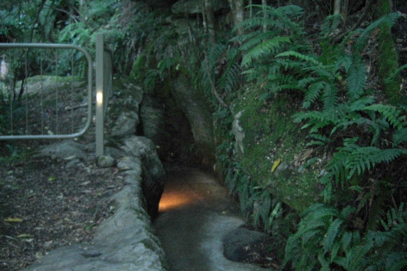
The first 50 feet is low so you must crouch.  You immediately discover a world of sculpted rock and rushing water.

By geological standards the caves are very young (12,000 years) and are still being carved out by the force of the river that flows through them.  The result is a twisting network of limestone passages filled with whirlpools and roaring underground waterfalls.
Deep inside the caves, beyond the roar of the water, thousands of glow worms inhabit a silent hidden grotto. You glide in boats in the subterranean darkness to view their  extraordinary,  glittering display.
We have discovered that there are many opportunities to view glow worms all over NZ.  On  a hike up the mountain, north of Wellington, we had an interesting talk with a local.  He said that he often took the hike early in the morning and the trees were aglow with the worms.  Frankly I have seen quite enough worms for one trip.
6. The Takahē
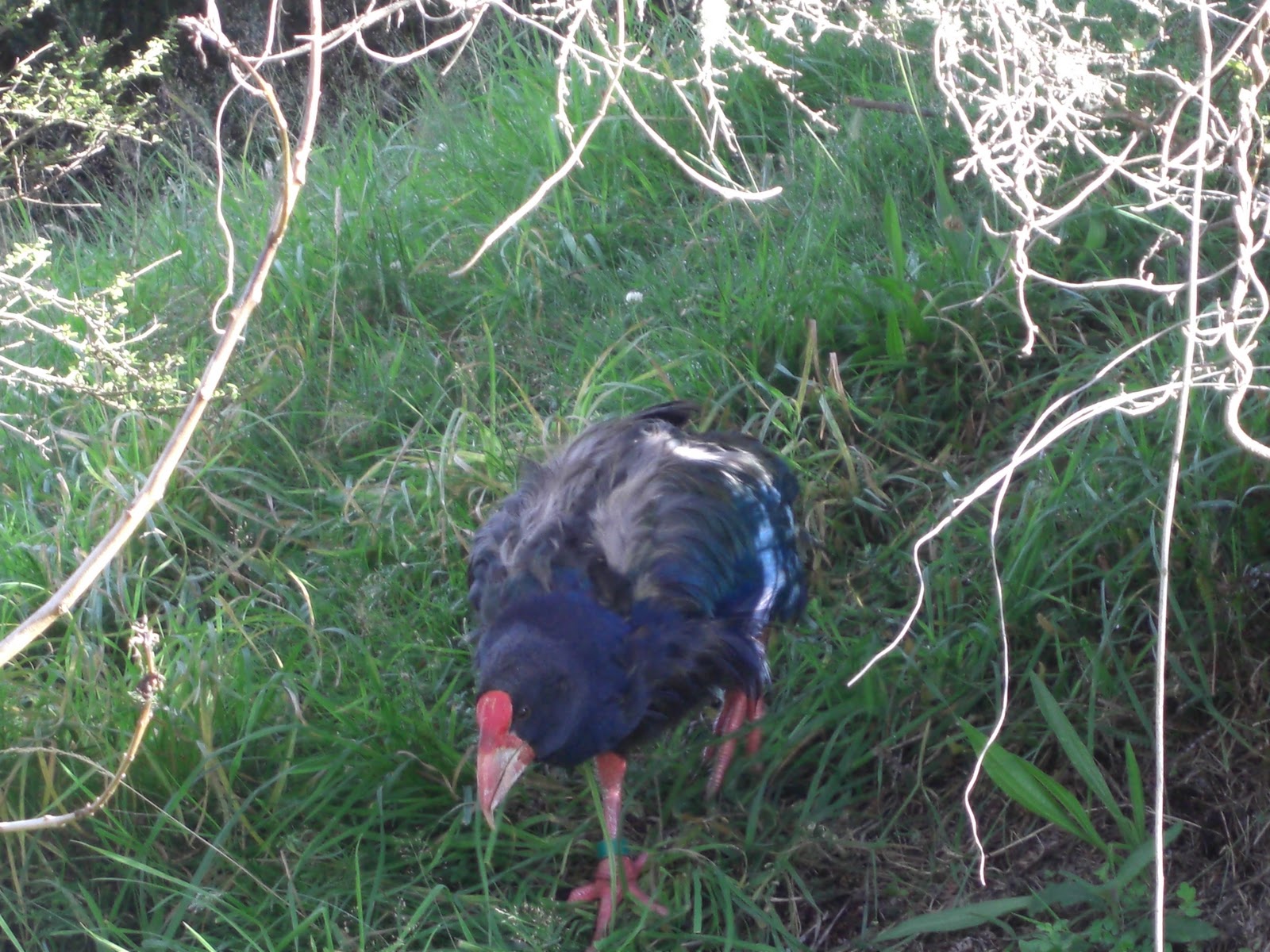
The Takahē is a flightless bird indigenous to New Zealand. It was thought to be extinct after the last four known specimens were taken in 1898. However, after a carefully planned search effort the bird was rediscovered by Geoffrey Orbell on November 20, 1948, near Lake Te Anau in the Murchison Mountains.
Don and I walked to the Te Anau Wildlife Centre to see the Takahē.   The adult is mainly purple-blue in colour, with a greenish back and inner wings. It has a red frontal shield and red-based pink bill. The legs are pink.
7. Deer Farms
Don and noticed that not only were there sheep farms and cattle farms on the south Island, there were also deer farms.  We saw a number of variety of deer especially the Wapiti and the Red Deer. We initially thought that some enterprising soul came up with the bright idea to import deer for the purpose of farming them.  We commented that if they got loose they would quickly multiply as there were no preditors to control the numbers.


It turns out that we had the acquisition part wrong.  Deer were introduced many years ago and predictably they did grow to such a number that they became a problem and still are.  Large numbers were removed from the wild and placed on farms.  Their meat and velvet is harvested for the oversea's market.  A few restaurants serve venison but you cannot buy it in the stores.
People are encouraged to hunt the deer in the national parks as there is still a large wild population.
8. Mammals
Originally there were no mammals in New Zealand other than two varieties of bats.  All other mammals have been introduced.  Some with devastating results to the indignious bird poplation.
Rabbits were brought in and, surprise, their numbers got out of hand.  The stoat were then introduced to prey on the rabbits.  Unfortunately, the stoat found the birds to be a far easier target.  The birds are easy to kill as they have never had to be wary of four-legged  preditors, only flying ones, like the hawk and the eagle.
Dogs also prey on the non-flying birds, like the kiwi and the weka.  Dogs have killed so many kiwi that their numbers are threatened.
Possums were brought in from Australia so that the hunters would have a target.  Again with devastating results to the bird population because they attack the nests and destroy habitat.
What is needed here are few coyotes, maybe even the wolf.  That would solve the varmit problem.  But then both coyotes and wolves love sheep.  And so on and so on...

9. The Southern Tip                                                                                                  February 5, 2011
We drove to Invercargill, had lunch then drove a little further south to the tiny township of Bluff.   We thought we had reached the southern tip of the South Island.  Not the southern most point of NZ because you'd have to go to Stewart Island to reach that point.

We ran into a Canadian couple from Summerland.  They took a picture of us under the Stirling Point Signpost (we reciprocated).

 It turns out that Bluff is not the southern tip of the South Island.    Later as I read another section of the guidebook I found our mistake.
You need to go further east to Curio Bay.  From Curio Bay a back road runs over to Slope Point, mainland New Zealand's southernmost point.   Heavy rains or unusually high tides can make the road impassable.  Slope Point is apparently a bit of a disappointment - just some farmland sloping to the sea.  Anyway not nearly as dramatic as the northern most point (Cape Rainga).

10. Heading Home
From the moment we turned north from the Bluff we have been heading home.  Back to Auckland, back to Sydney and then back to Calgary.  By the time we get home Don will have taken 14 different flights and me 13.    I think I will stay off planes for awhile.    

14. Other
Kea, Parrot Bird - very clever
    

Saturday, February 5, 2011

South Island

1. Pelorus Bridge
 We spent the first two nights on South Island at Pelorus River Campground (located on the highway between Picton and Nelson).  The river is cold and clear and is a favourite swimming site for the locals and visitors alike.  All day long groups of teenagers and young adults were leaping off the rocks into the water.  Only to clamber out  and jump in again.  It was fun to just stand on the bridge and watch them at their antics.
 There are stern warnings on the bridge not to jump from the bridge.  It states that people have died, so do not try.


Other than swimming there are some major tramping trails that leave from the site.  Don and I did one walk  that went past two waterfalls before heading straight up the mountain to the lookout.  It was a 4 hour return.  The peak was 417 metres.

The difference between a walk and a tramp is the distance and the need to carry a pack with a lunch or an extra jacket.  We should have prepared for a tramp instead of just a walk.  We did, however, have our water bottles.
 My brother Chris gave us the bottles three trips ago.  His company gave them out to their employees.  We almost lost them early on in the trip as we left them in our hotel fridge in Melbourne before flying on to Tasmania.  It was lucky that we were returning to the same hotel 5 days later.  The housekeepers had kept then for us.  We haven't left them since.


2. Nelson
We arrived in Nelson on Sunday.  Monday was to be a national holiday - Anniversary Day.  Sort of like our Canada Day.  The kids are soon back to school.
Nelson is a beautiful city.


We looked into booking a quad tour but it wasn't going to work out.  The clock is ticking and we want to reach the southern tip (the city of Invercargill) before we are out of time.  The length of the southern island is around 1000 kilometres.
3. Abel Tasmin National Park
From Nelson we took the road towards Abel Tasmin National Park - easily one of New Zealanders favourite vacation sites.  Unfortunately the wind was strong.  Don had to fight to keep the van on the road.  As we drove along we passed vineyard after vinyard.  There were also fruit plantations but by far the most prevalent crop were the wine grapes.
We stopped at Kaiterteri Beach which is on the edge of the park.

The blowing sand made it impossible to enjoy the setting.  After lunch we decided that it was pointless to stay in the area.   We retraced our route heading towards the west coast and the next stop on our itinerary.
4. Towards The West Coast
 After we left the vineyards behind we drove into more rugged terrain.  The vineyards gave way to the forestry industry.  The hills were in various stages of production.  Some were clearcut, waiting for the tree planters to come in and re-plant.  The spontaneity and variety of nature has been replaced with straight rows of one type of tree.  All the surrounding hills were in various stages of regrowth - from 1 year all the way to ready for harvest.  
 We stopped in Woodstock (west of Nelson) to take a break.  Don slept and I read.  The quiet was shattered by the sound of an air raid siren. ( Even if you never lived through WW2 because of the movies we all know the sound). We jumped up to see what the locals were doing, planning to take our cue from them.  The clerk in the antique store seemed to be reading.  Two people across the way were looking off to the west.  We looked too.  Soon we heard the sound of a fire engine.  What a way to announce a fire!!!
We stopped the night at a government campsight in the Lyell Upper Gorge.   The campground is on the site of an old mining town.  All that is left of the area is pictures, stories, and a graveyard.  The last hotel burned down in 1963.

5.  February 1, 2011
Where does the time go.  One month of 2011 gone just like that.
We are along the west coast and the nights are cool.  We could be in Alberta in the spring time as the weather is the same - cool at night aand warm throughout the day.  (The average summer temperature is 19.5 degrees C. The average winter temperature is 12.5 degrees C.  The annual rainfall is 2575 mm.)  Just don't look too closely at the vegetation.  A dead give-away.
The west coast is New Zealand's most unpopulated region.  We drove all day along the coast from Westport to Greymouth and didn't see one boat.
Our first two stops were near the city of Westport and close to each other.  At the 'T' one way led to  Cape Foulwind (named by Captain Cook),  the other direction led to the seal colony.  We went to Cape Foulwind and saw that instead of driving to the seal colony you could take the path along the sea cliff.  It was a beautiful clear day.  We choose to walk but this time we prepared properly for a tramp.  We carried a pack with lunch and water.  The round trip was 7 kms  and was one of the most enjoyalbe hikes we have taken on this trip.


From there we  drove south to Punckaiki, the site of the Pancake rocks and Blowholes.  An interesting sight.  Layers of rock cemented together.  The scientists have figured out what process had to have taken place to create the effect.  What they can't figure out is why and exactly how.


6. Wednesday, Feb. 2nd
We have woken up to rain.  It looked like it was there for the day but we did drive out of it around  1:30.
We shopped for jade in the jade capital - Hokika - a cute artsy town.  The rain poured down but shopping and rain go to gether nicely.
From there we headed to Okarito where we were going to kayak in the lagoon.  The rain had stopped by this time but not the wind.  The lagoon was rough with white caps.  We determined to stay on dry land.

Onwards to Franz Josef to see the famed glacier.  A tourist town at it's finest along with the inflated prices.  We paid $2.22/litre for gas.  We walked to the glacier for a peak but chose not to do any of the pricier options like take a guided tour or a heli-ride.

 We left and drove to Lake Matheson.  Think of Emerald Lake and that will describe the setting.  We did the circle walk around the lake (1.5 hr) admiring the reflections in the calm waters.  From that area you also get a good view of Mount Cook which is the highest peak in the NZ mountains


7. Water and Curvy Roads
The South Island can be summed up in two phrases - water and curvy roads.  We have never seen so many hairpin curves in our lives.  And water - water everywhere.  Falling from the sky, running in rivelets, streams and torrents.  The crashing of waves and, occasionally, a tranquil lake.  New Zealand is a land of many contrasts wrapped up in one small package.


Saturday, January 29, 2011

Mother Nature Soaks the Kiwis

Rain - The Most Annoying Element in Mother Nature's Arsenal
Whoever said, "The good thing about rain is that you don't have to shovel it," ought to be shot.  We picked up the rental camper van on Saturday afternoon just ahead of the rain that came down in sheets without a moment's pause until we managed to drive out of it on Monday at 4:00 pm.  I mean typhoon class rain.  During the height of it (Sunday afternoon) I would gladly have been standing in my driveway bundled-up with a snow shovel in my hands.  And this was nothing to the rain that devastated the east coast of Australia.  That was the most expensive natural disaster in their history.


There was nothing we could do other than huddle in the cramped confines of the van and listen to the drumming on the roof.  Sunday afternoon in Rotorua we sought out a sports pub and sat and watched tennis.  After the match we were able to catch the weather forecast.  The broadcast would determine which direction we drove in the morning.  Wanganui, on the west coast, was forecast to have sunshine by Monday afternoon.

On the drive towards Waganui we skirted mud, rock and boulder slides.  Some of the rocks were the size of fitness balls.  If a car was unlucky enough to be passing as one came down that would be a case of being in the wrong place at the wrong time.  We drove through flooded patches of highway.  Some areas were so flooded that only one lane was open and maintenance crews were on hand monitoring the situation.  I kept having visons of our van floating away across the tree tops like the scenes that took place north of Brisbane.  You just never know.


In Wanganui the sun was out and so was half the population.  There was a constant stream of vehicles driving down to the river to see the level and to witness the fact that a major portion of their boardwalk was underwater.


Man can control most things but not mother nature.  Whine, rail and complain all you like but that is the way of it.
Post script  - when Don and I picked up the camper van the woman signing it out  asked if we were on our honeymoon.  Imagine! I guess because of the cosy nature of the space.  After 3 days of rain in that van I thought that if we had been newly married we'd be divorced before the ink was completely dry on the certificate.


Neat Down Under Innovations
Two things that are neat innovations and are found in both Australia and New Zealand are:
1.  BYO restaruants - these are restaurants that allow you to bring in your own wine.
2.  Camping ensuites - a powered campsite with a private ensuite (a little cabin)  that  comes along with the sites.  Inside is a toilet, shower and over-sized sink.


Waitamo Area
The one  touristy activity that we did during the diluge was to go the Waitomo district to take in one of the cave excursions that the area is famous for.  Steve and Julia did the Waitomo Glow Worm cave cruise.  As I am not overly fond of the crawly little creatures Don and I went in the Ruakuri Cave.


According the the Maori legend ('rua' meaning den, and 'kuri' meaning dog) was first discovered 400-500 years ago by a young Maori hunting birds.  He was attacked by wild dogs just outside the original cave entrance.  The cave was re-opened in 2005 and is an amazing example of engineering and natural cave structures.  You descend into the cave by a spiral staircase (15 feet across) that was excavated one metre at a time and encased in cement as it was exposed.  The walkways are suspended from the cave walls by steel cables.  The dripping-water carved limestone features of the cave were varied: stalactites, stalagmites and ribbon formations.
(You actually do see the glow worms but they are in small clusters and off to the side instead of overhead.) An unexpected sign in the cave states, "No trespassing.  Trepassers will be prosecuted."

Apparently a local farmer in the 60's, because of the title he held to his land, said that he owned everything on his land that reached to the heavens and to the centre of the earth.  The case was tied up in the courts for a long time.  In the meantime the cave was closed to all but the Maori's.  The end result was that the farmer lost his argument.  It was deemed that the caves were just air and thus were not real estate.  Go figure.

Wellington                                                                                                       Thursday, January 26, 2011
The seat of Kiwi government since 1865.  I am constantly amazed at just how long both Australia and New Zealand have been well established countries.
We spent the day strolling around downtown, especially along the wharf.  Always lots going on at the seaport of major cities.

We sat and listened to an old busker sing and play the blues for over 30 minutes.  In that whole time only one person dropped a donation in his collection box.  A girl of 10 or so walking along with her parents and her brother, asked her dad for some money to drop in his open guitar case.  Other than that everyone walked by as if blind and deaf.
And, yes, when Don and I left we did make a respectable contribution.
There were quite a few museums to choose from.  We only went into one - the Te Papa Tangarewa Museum.

There were some unusual exhibits.  One was a simulated earthquake.  Not something you'd want to experience for real.
People living in NZ have to expect lots of little shake-ups from earthquakes - and, at some time, a big one!
Shake, Shatter, Slide
Ground shaking, rocks breaking, surface layers sliding - these are some of the effects of large earthquakes.
Wellington, like Kobe in Japan and San Francisco, is a city built on an "active" fault.  There's at least one shallow earthquake recorded under Wellington City every week.  Would you sleep well at night?

From North to South

On Friday we took the ferry to the south island.
 It travels between Wellington and Picton and takes 3 hours.


Other:
The only kiwi we have seen - a museum exhibit
                        
Looking for breakfast